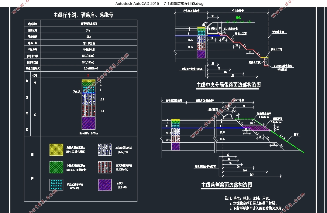
吴圩至崇左高速公路W1段施工图设计(含CAD图)

吴圩至崇左高速公路W1段施工图设计(含CAD图)(任务书,开题报告,外文翻译,论文计算书16000字,CAD图13张)
摘要
本设计为广西省境内新建公路某段的初步设计。根据设计公路的交通量统计和计算数据及其使用任务和性质,将道路等级确定为高速公路。广西省地处中国华南地区西部,路线所经地形为山地丘陵区。结合当地自然状况及规范规定,进行线路平面设计、纵断面设计、路基设计以及横断面设计。此外对线路支挡防护、排水及土石方调配进行初步设计。设计最终资料包括平纵横、路基设计、线路防护排水及土石方设计图表。本线全线总长9860.729m。有 7个平曲线、9个竖曲线、桥梁2座,设计车速100km/h,路基宽度26m。本设计中主要运用了纬地5.88公路选线设计软件、纬地土石调配软件及PHDS2006路面设计软件进行相应各项的设计。
关键词:广西,山地丘陵,高速公路,平纵横设计,路基路面 ,排水
The construction drawing design of the W1 segment of the highway from WuWei to ChongZuo
Abstract
The design is a preliminary design of certain partial of a new way which located in Shandong province. According to the statistical and calculated date about the traffic of the designing way, the use tasks and nature, the level for the road is determined highway. Guangxi province located in south west China. Route through the hilly area. Combined with the local natural condition and the rules and regulations, do plane design, longitudinal design, roadbed design and cross-sectional design. In addition to the road retaining protection, drainage and earth allocation do preliminary design. The eventually design material including plane, longitudinal, cross-sectional, roadbed designing charts, road protection, drainage and earth allocation designing charts. A total length of the route is 9860.729 meters. There are 7 horizontal curves, 9 vertical and two bridges in the route. The lane design at 100 Km per hour, and the width of subgrade is 26 meters. The main software used in the design following: Hint CAD 5.88 to highway route design software, Tsfdp V2.5 to earth-rock allocate software, Hpds2006 to pavement design software.
Key Words:Guangxi, Mountainous and hilly region, Highway, linear design, subgrade, pavement, drainage
工程概况
此次毕业设计资料来源于工程实际:吴圩至崇左高速公路工程。该项目为全长26.384公里、宽24.5米高速公路采用设计速度100公里/小时起自扶绥空港经济区建设大道终点沿扶绥空港经济区规划路网走向至林碰村之后路线向东经王令村、那标、那烈、那洋、康宁水库、康宁村路线终于南宁至吴圩机场高速公路明阳互通式立交接南宁至吴圩机场高速公路和明阳工业区一级公路项目全线共设置桥梁10座长828.5米其中:大桥2座、中桥6座、小桥2座;涵洞76道隧道1座通道10处上跨分离式立体交叉共4处,互通式立交1处,平面交叉6处,养护站1处。
[资料来源:http://doc163.com]


目录
摘要 I
Abstract II
第一章 绪论 1
1.1工程概况 1
1.2地理信息 1
1.3设计背景及意义 2
第二章 路线设计 3
2.1 线形设计一般原则 3 [资料来源:http://doc163.com]
2.2 平面线形要素的组合类型 3
2.3 平面设计方法 4
2.4 平曲线设计 4
2.4.1 平曲线要素计算 4
2.4.2 逐桩坐标计算 6
2.5 纵断面设计 6
2.5.1 竖曲线设计 6
2.6 横断面设计 8
2.6.1 路基宽度的确定 8
2.6.2 路堤和路堑边坡坡度的确定 8
2.6.3 超高设计 9
第三章 路基路面设计 10
3.1 一般路基设计 10
3.1.1 路基的类型和构造 10
3.1.2 设计依据 10
3.1.3 路基填土与压实 10
3.2 软基处理 12
3.3 路基防护 12
3.4 支挡结构设计 12
3.5 路面结构设计 14
3.5.1. 路面结构组成 14
3.5.2 路面类型 15
3.5.3 沥青路面设计 15 [资料来源:http://www.doc163.com]
3.5.4 水泥路面设计 18
3.5.5 路面比选 23
3.6 路基土石方数量计算及调配 25
3.6.1 横断面面积计算 25
3.6.2 土石方数量计算 25
3.6.3 路基土石方调配 26
第四章 排水设计 30
4.1 公路排水设计的内容 30
4.2 设计依据 30
4.3 路基排水设计 30
4.3.1 地表排水设备的类型 30
4.3.2 边沟设计 30
4.3.3 排水沟设计 31
4.4 路面排水设计 32
4.4.1 路面表面排水 32
4.5 涵洞设计 32
4.5.1 涵洞分类及各种构造型式涵洞的适用性和优缺点 32
4.5.2 涵洞选用原则 33
致谢 34
参考文献 35 [来源:http://www.doc163.com]
